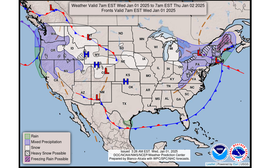
The latest significant lake-effect snow event will bury areas to the east of Lakes Ontario and Erie from late Wednesday through the weekend. In some spots, feet of snow are possible, with hazardous road conditions and concerns for travelers.
With lake-effect snow warnings in place, accumulation of over 2 feet is possible in the most persistent bands near and south of New York’s Tug Hill Plateau.
However, compared to lake-effect snow events during December, the bands near Lake Ontario will be located farther south, this time targeting places such as Syracuse and Rome, New York, especially over the weekend. The impacts for more northerly locations, such as Watertown, N.Y., won’t be as notable compared to recent events.
This will cause treacherous travel conditions along Interstates 81 and 90 in central and western New York, as well as in northwestern Pennsylvania, northeastern Ohio and parts of western and northern Michigan, where winter weather advisories are in effect.
Motorists should expect dangerous, snow-covered roads and the potential for whiteout conditions due to gusty winds of 40 to 45 mph.
When and where snow will fall
By the end of the weekend, over 2 feet of snow may accumulate in the heaviest snow bands — which is a narrow corridor of heavy snow — in central New York, especially north of Syracuse. Totals of 1 to 2½ feet are possible south of Buffalo as well as in Canada’s Ontario, west of Barrie.
Blustery winds will cause blowing and drifting of the snow, leading to very difficult or impossible travel conditions, as well as a risk for frostbite on exposed skin.
A storm system will bring wet snow and light accumulations to the region on Wednesday before the snow bands become more organized on Thursday.
That’s when the heaviest snow will probably focus over Oswego, Lewis and Oneida counties in New York, impacting places like Oswego, Fulton and Rome — and potentially extending as far east as Albany.
The event will continue into Friday, although a fresh surge of cold air and separate disturbance may cause the winds to shift from west to northwest, resulting in a change in the orientation of the snow bands.
Later Friday, the main snow band could sag southward into Syracuse, while other snow bands affect western New York, including Jamestown, northwestern Pennsylvania, including Erie and Bradford, northeast Ohio, Michigan and Ontario.
On Saturday, northwesterly winds are forecast to continue, with New York’s Finger Lakes region potentially experiencing heavy snowfall.
Strong winds in the lower atmosphere may cause the snow bands to extend farther east than normal, with the potential for flurries to reach the Eastern Seaboard.
By Sunday, winds may shift again as a new storm forms to the south. This could result in the lake-effect snow bands shifting north before fizzling out by Monday.
Why so snowy?
There are several important ingredients for heavy lake-effect snow, but the main one deals with the temperature difference between the lake and the atmosphere above.
The Great Lakes continue to run warmer than average, with Lake Michigan at record warm levels.
The larger the difference is between the lake temperature and the air temperature about a mile above the ground, the more intense the snow bands can become.
An Arctic air mass, like the one that will sweep across the region from Friday into Saturday, can dramatically increase the temperature contrast.
Lake Ontario is around 42 degrees Fahrenheit. The air about a mile above the ground is forecast to be around 5 degrees Fahrenheit. This difference of around 37 degrees far exceeds the 23-degree difference needed to produce lake-effect snow.
Winds will also be conducive to heavy lake-effect snow bands through the weekend. A west-to-northwest wind flow may cause a lake-effect snow band from Lake Huron’s Georgian Bay to join forces with one over Ontario, leading to more snow in central New York.
The lakes are currently ice-free, meaning that they’ll provide ample moisture that will provide fuel for developing and intensifying snow bands.
A region that stands out
The Great Lakes are one of the few regions of the country that have been snowier than normal this season.
Parts of Lewis and Chautauqua counties, N.Y.; Erie County, Pa.; Ashtabula County, Ohio; and Huron County, Mich., have all experienced two to three times their normal season-to-date snowfall.
With several Arctic air masses to come during January, more lake-effect snow events are expected in the weeks ahead.
However, frigid temperatures can lead to increasing ice coverage across the Great Lakes, which can decrease moisture availability, evaporation and the chance for significant lake-effect snow events.
For now, ice on the lakes is almost nonexistent, which will continue to leave the door open for heavy snow.

(National Weather Service)