BANDON, Ore. — The warnings of a looming cataclysm are ubiquitous along the Oregon Coast. On blue-and-white signs, a cartoon wave curls out of the sea, capital letters blaring: TSUNAMI HAZARD ZONE. Harbingers of a future disaster are always in the periphery, staked next to highways, on neighborhood streets, between the crab shack and the chowder house.
A massive earthquake will one day rattle the region. Minutes to hours later, a surge of seawater will swallow the land. No one knows when.
In the late 1980s, scientists began to recognize that one of the biggest hazards on the planet lurks just off the coast of the Pacific Northwest. The Cascadia Subduction Zone, where one plate of the Earth’s crust dives beneath another, stretches from Northern California to Canada’s Vancouver Island, getting stuck and building up stresses. Until the day they release.
The last time this happened was more than 300 years ago. That means to understand the future risk, scientists must reconstruct the past. This summer, a team of tsunami detectives, clad in waders and knee-high muck boots, trudged into soggy marshes at the mouth of Oregon’s Coquille River — on the hunt for buried catastrophes.
Finding this record intact isn’t easy.

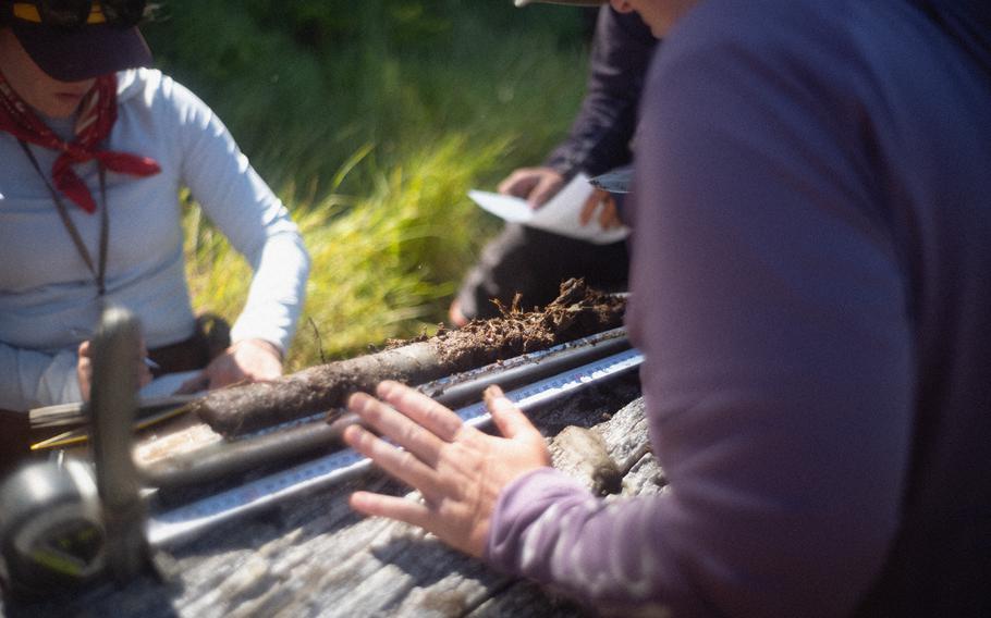
Core samples taken along the Oregon Coast open a window into the past, but, in the present, it’s brutal work, one scientist said. (Olivia Bee for The Washington Post )
On a sunny July day, scientists wove their way through waist-high marsh grasses, stepping over driftwood trip hazards and sneaky, ankle-twisting channels. They were searching for “1700” — a 9-magnitude temblor that year that shook the land, caused large swaths of the coast to sink down several feet and triggered a tsunami. To find evidence of it, they plunged the pointy tip of a cylindrical metal tool called “the Russian” deep into marshy sediment, twisted it like a corkscrew through layers of peat, sand and roots, and yanked up a core. Again and again and again.
To a layperson, these cores would be an unintelligible tube of waterlogged sediment. But to Virginia Tech paleoseismologist Tina Dura, they were part mystery, part puzzle, part history book.
Starting at the bottom, a brown, peat layer that gave off a sulfur aroma was the marsh, pre-earthquake. A grayish layer on top of it was 1700 — fine sand washed in by the tsunami right after the earthquake. On top of that was gray silt, evidence that the quake had caused the land to drop down, transforming what had once been high marsh into a tidal mudflat. Above that was a more gradual transition, representing centuries of uplift and marsh formation, to a brown soil that looked eerily similar to the marsh before the disaster.
“This was a rough day for the marsh, for sure,” Dura said, scraping a sharp knife over the sandy section of the core, carried in by the tsunami. “And basically, what we’re standing on today looks a lot like what was pre-1700 earthquake.”

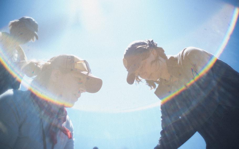
Brett Hanley, right, a Carleton College undergraduate; Lydia Staisch, a U.S. Geological Survey research geologist; and Bering Tse, left, a graduate student at the University of Washington, work at Bandon Marsh on the Oregon Coast. (Olivia Bee for The Washington Post)
A really big one, or a decade of terror?
In earthquake hot spots around the world, people have often felt occasional tremors or heard stories passed down in family lore. In California, small quakes are periodic and the risk of “the big one” is part of the culture. The scale of risk to the Pacific Northwest is hard to grasp: ground-shaking that lasts five minutes, more than 600,000 buildings toppled or damaged, 13,800 deaths and more than 100,000 injuries, according to a 2022 plan from the Federal Emergency Management Agency. The economic losses from the earthquake alone have been estimated to reach $134 billion.
But near the Pacific Northwest’s particularly fraught fault zone, where the Juan de Fuca plate located just offshore dives beneath the North American continental plate at the rate fingernails grow, geologists trade stories that illustrate the mismatch between human and geologic time scales.
“I’ve had people tell me, ‘I’ve lived here my whole life. My parents lived here. What are you talking about?’ ” recalled Carrie Garrison-Laney, a tsunami hazards specialist at the Washington Sea Grant, based at the University of Washington and part of a national network administered by the National Oceanic and Atmospheric Administration.
Dura recalls visiting a historic house in Oregon built in 1898 and being assured by the curator: “It’s survived every earthquake. So we’re not worried.”
Among Native people who have lived in the region much longer, there are oral histories of sea flooding that uprooted trees and swept away villages. Many tribes in the region have stories of supernatural creatures, called Thunderbird and Whale, who cause the earth to shake and the ocean to flood.
Despite that ancient wisdom, the conventional scientific puzzle took longer to piece together.

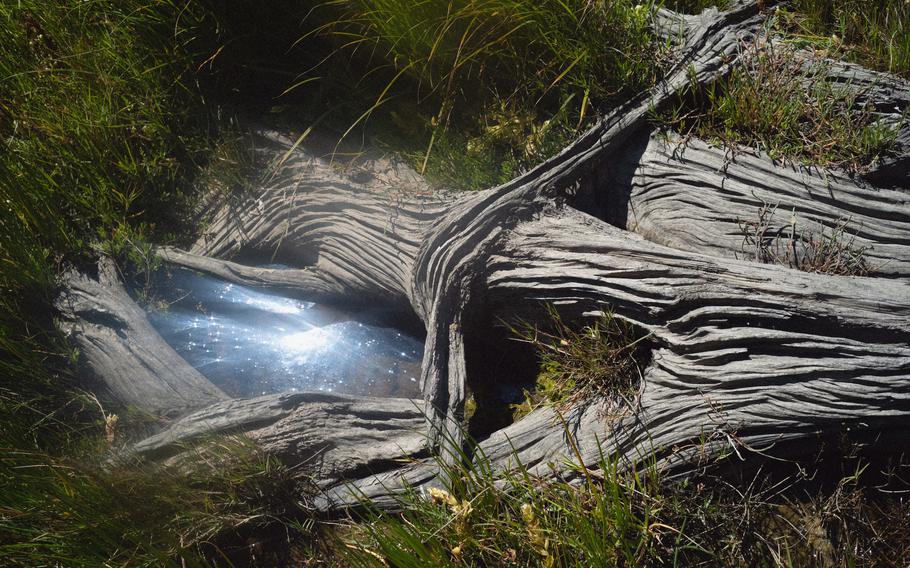
Stumps, the remnants of trees killed by tides, are scattered across Bandon Marsh. (Olivia Bee for The Washington Post )
In the 1980s, geologists discovered buried tidal marshes along the coast — indicators that the land had sunk down at some point. A clue to the timing came from stands of stumps and dead trees, called “ghost forests,” that were killed when the land abruptly dropped down, leaving forests to be submerged by tides — somewhere between August of 1699 and May of 1700. A final clue came from Japanese historical records. Tsunami waves swamped not only the nearby coast, but traveled nine hours across the Pacific Ocean — and written records recorded an “orphan tsunami” that swamped Japan without being preceded by local shaking — allowing scientists to pinpoint the last big Cascadia earthquake to Jan. 26, 1700.
Scientists now believe there have been at least 19 major, megathrust earthquakes triggered at the Cascadia Subduction Zone in the past 10,000 years.
But the data is still too sparse, said Diego Melgar, a University of Oregon seismologist who works on models that generate tens of thousands of theoretical earthquake scenarios, which can vary in how large the quake is, how much the fault slips and whether the entire zone ruptures at once, or in fragments.
While many scientists have assumed that 1700 was a single, catastrophic event, Melgar said uncertainties in the data don’t rule out the possibility there were two or three slightly-less-giant quakes. For planners and policymakers trying to fathom future risk, understanding that is consequential: the difference between one really big one, and a decade of terror.
To narrow down which earthquake scenarios are likely, Melgar tells scientists including Dura, “Guys, I need more data!”
That means more cores. “I’ve been out to the marshes a few times with them,” Melgar said. “After you go out there a few times, you’re like, ‘Oh, this is why we don’t have more data. It’s brutal work.’”

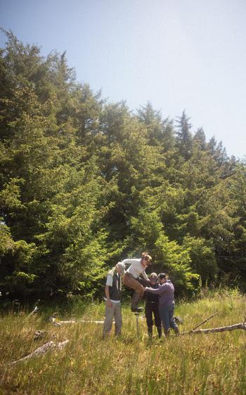
Scientists take a sediment core in July near the mouth of the Coquille River on the Oregon Coast, part of their quest to find buried evidence of tsunamis and earthquakes that struck the region. (Olivia Bee for The Washington Post)
Algae fossils spill secrets
By the 11th core of the day, the scientists were a little loopy. Some lay on the ground, or reclined on bent-over stalks of marsh grass as they ate snacks and tried to avoid sunburn. Andrea Hawkes, a paleoseismologist from the University of North Carolina at Wilmington, used a knife to cut off small sections of sediment, pinching them between her fingers and sniffing them to classify each section, while Virginia Tech graduate student Brandon Hatcher took notes.
In Hatcher’s backpack were a few cores, packed in PVC tubes cut in half, swaddled in plastic wrap and taped with blue painter’s tape. The tubes will be shipped back to the lab for more painstaking study.
Scientists will slice thin cross sections, add hydrogen peroxide to get rid of decaying plant matter and use a microscope to examine fossils of single-celled algae called diatoms. Diatoms are sensitive to salinity and tides, so identifying which species inhabit a particular layer of sediment can reveal what the environment was like. Some thrive in the high marsh and others in tidal mudflats. By studying which kinds of diatoms are present, scientists can come up with estimates of how high the land was relative to sea level before a quake — and after it dropped down.
Quantifying how much the land subsided will help scientists such as Melgar figure out which earthquake scenarios are more realistic. Dura is also interested in using the information to understand how floodplain maps will be redrawn after an earthquake. Sea level is rising gradually due to climate change, but in the Pacific Northwest, there’s an additional factor to consider: Sea level could rise by up to six feet in an instant after an earthquake causes the land to drop. That means places that weren’t previously prone to flooding would be at risk.
While the broad strokes of the tsunami risk are known, the details matter in seismology — and the only way to answer those questions is to sink more holes into the ground.
“In many of these places, when they were visited in the ’80s and ’90s and 2000s, they might have collected, one core, two cores,” Melgar said. “But when I run a tsunami model … what we really would like to know is does this one model get the sand to all the places there was sand in the past?”
A landscape of hazard
None of this work can answer the question at the top of most people’s minds: When is this big one coming? But geologists hope to provide the best science to give people, planners and policymakers the best chance to prepare.
Melgar leads the Cascadia Region Earthquake Science Center (CRESCENT), a $15 million National Science Foundation research initiative that began in 2023 to bridge gaps between scientists who study different aspects of Cascadia but may have been isolated in their own silos — and to connect policymakers to the latest science.
Valerie Sahakian, a lead investigator for CRESCENT, recalled that at a recent event, experts who work on resilience at utilities, federal agencies, emergency management and grassroots organization came together. It was a rare networking opportunity for people from across disparate industries and backgrounds to discuss challenges they share in preparing for a future emergency.
“It’s three states and two countries. And so it’s challenging for everybody to be working in unison,” Sahakian said. “For things like critical infrastructure, like dams and energy hubs, they still need the best science. What we have right now, they’ll work with. But it really isn’t good enough.”
To be a seismologist in the Northwest is to be a Cassandra. Scientists look at bridges and other infrastructure with a discerning eye. Some communities along the coast simply won’t be able to evacuate quickly enough, but only a handful of tsunami evacuation towers for people to take refuge have been built. The building next to Melgar’s, the one where the volcanologists at the University of Oregon work, is constructed of unreinforced masonry — a structure that he knows will be vulnerable when the next big one comes.
Sahakian, who surfs, said when she goes out, there are places on the coast she avoids because it will take too long to get out of the water and out of the hazard zone if a quake strikes.
Dura said there’s a spot on the coast where she sees people park RVs on a narrow spit of sand, with one bridge off — one person’s bucolic camping adventure, a scientist’s nightmare waiting to happen.