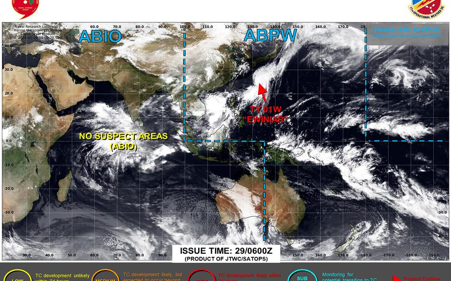
Ewiniar has made closest point of approach to Okinawa, continues heading rapidly northeast and losing its punch along the way. (Joint Typhoon Warning Center)
5 p.m. Wednesday, May 29, Japan time: Closest point of approach by Typhoon Ewiniar to Okinawa has come and gone. It remains a Category 1-equivalent typhoon, for now, and is moving rapidly northeast toward cooler waters south of the Tokyo area, losing its punch along the way.
At 3 p.m., Ewiniar was 290 miles east of Kadena Air Base, hurtling northeast at 23 mph, packing 75-mph sustained winds and 92-mph gusts at center. All U.S. bases in Japan and Okinawa remain in seasonal Tropical Cyclone Conditions of Readiness.
Joint Typhoon Warning Center forecasts Ewiniar to pass 155 miles southeast of Yokosuka Naval Base at mid-morning Friday, still packing tropical storm-strength winds, 46-mph sustained and 58-mph gusts.
But at that point, it’s forecast to be losing its tropical characteristics, transitioning into a cold-core low as it heads northeast over the Northwest Pacific Ocean. Storm Tracker will keep an eye on it in case anything changes.
Typhoon Ewiniar forecast track from JTWC: https://www.metoc.navy.mil/jtwc/products/wp0124.gif
Typhoon Ewiniar forecast ensemble package: https://www.tropicaltidbits.com/storminfo/#92W
Saffir-Simpson hurricane scale: https://www.nhc.noaa.gov/aboutsshws.php
Yokosuka’s official Facebook page: https://www.facebook.com/cfayyokosuka
Yokosuka’s official weather forecast: https://www.metoc.navy.mil/noacy/five-day_yoko.htm