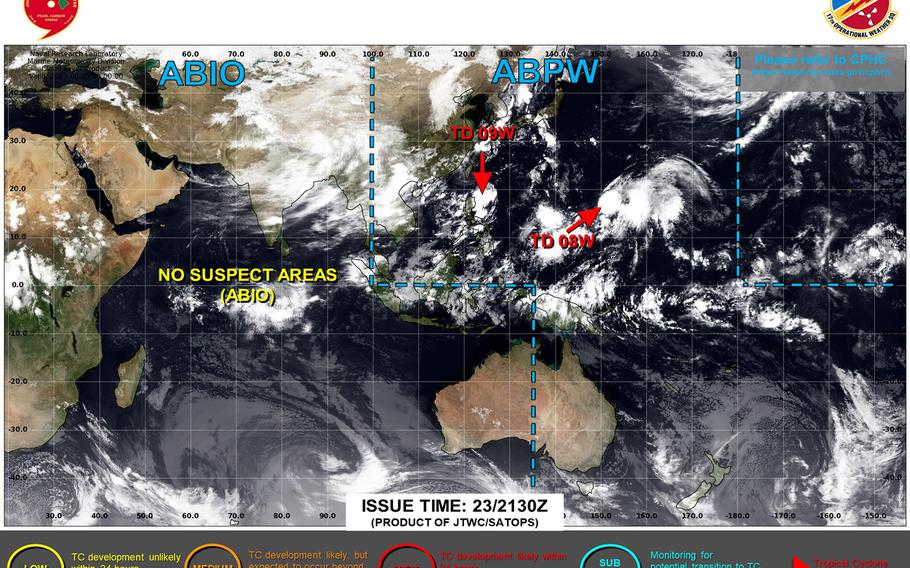
A second tropical cyclone forms and quickly becomes a tropical storm; each remains well away from land masses. (Joint Typhoon Warning Center)
11:15 a.m. Thursday, Aug. 24, Japan time: It didn’t take long for the new tropical cyclone southwest of Okinawa, 09W, to become a tropical storm. It has joined Tropical Depression 08W, southeast of Japan, as traffic keeps picking up on Typhoon Highway.
At 9 a.m., 09W was 478 miles south-southwest of Kadena Air Base, trudging northwest at 7 mph, packing 40-mph sustained winds and 52-mph gusts at center. U.S. bases in Japan remain in seasonal Tropical Cyclone Conditions of Readiness.
Joint Typhoon Warning Center projects 09W to edge north briefly, then make a sharp left turn south, gathering strength over the lush, warm waters of the Philippine Sea, then curve northeast, peaking as a Category 4-equivalent typhoon at mid-morning Tuesday, still 437 miles south-southwest of Kadena.
Model-track guidance and forecast ensembles remain all over the lot regarding 09W. Still a very young storm, though developing rather quickly. Stay tuned. This one bears watching.
Then, there’s 08W, which at 9 a.m. was 1,438 miles south-southeast of Yokosuka Naval Base, crawling west-southwest at 5 mph and holding steady at 29-mph sustained winds and 40-mph gusts at center.
JTWC forecasts 08W to zig northeast, then zag northwest, peaking as a tropical storm, 63-mph sustained winds and 81-mph gusts early Sunday morning, and pass 354 miles east of Yokosuka early Tuesday morning. Storm Tracker has the watch.
The next two names on the list of names accorded to tropical cyclones in the Pacific are Saola, which stands for an animal recently found in Vietnam; and Damrey, Cambodian for elephant.