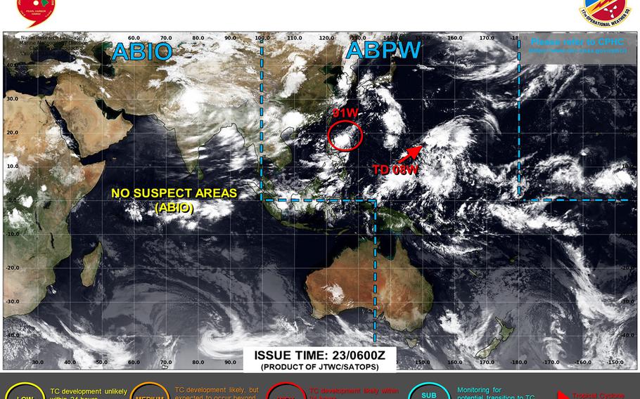
Tropical Depression 08W spawns well southeast of Japan, 91W Invest forms south of Okinawa. (Joint Typhoon Warning Center)
6 p.m. Wednesday, Aug. 23, Japan time: Traffic is picking up again along Typhoon Alley, with a new tropical depression well southeast of Japan and a second tropical disturbance a goodly distance south of Okinawa.
At 3 p.m., Tropical Depression 08W was 1,417 miles south-southeast of Yokosuka Naval Base, moving west-northwest at 6 mph with 35-mph sustained winds and 46-mph gusts at center. U.S. bases in Japan remain in seasonal Tropical Cyclone Conditions of Readiness.
Joint Typhoon Warning Center projects 08W to arc northeast for a couple of days, then northwest toward the end of its five-day forecast period as a tropical storm.
Long-range model-track guidance and forecast ensembles indicate a zig-zag track taking it off the coast of the Kanto Plain; how close and how strong, remains to be seen.
As for the disturbance labeled 91W Invest, at 9 a.m., it was 508 miles south of Kadena Air Base, heading northwest at 7 mph.
Model-track guidance and forecast ensembles also depict it making a zig-zag walk before heading toward Taiwan. But solutions are all over the lot at the moment; it’s still a very young disturbance. Storm Tracker has the watch.