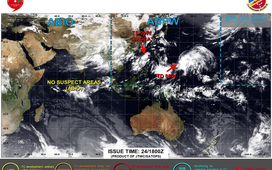
Damrey upgraded to tropical storm, remains forecast to stay away from U.S. bases, as does Tropical Storm Saola. (Joint Typhoon Warning Center)
1:20 p.m. Friday, Aug. 25, Japan time: Damrey has been upgraded to a tropical storm, and remains forecast to stay well off the east coast of Japan as the new work week begins, according to Joint Typhoon Warning Center’s latest forecast track.
Tropical Storm Saola, too, remains well southwest of Okinawa. JTWC’s forecast track continues to take it in a circular motion just east of the Philippines, then on course to possibly split the difference between southern Taiwan and northern Luzon.
At 9 a.m., Saola was 506 miles south-southwest of Kadena Air Base, crawling south at 3 mph and had strengthened to 63-mph sustained winds and 81-mph gusts at center. Saola could become a typhoon as early as Friday evening.
JTWC projects Saola to strengthen as it moves south over the lush, warm waters of the Philippine Sea, then turn north, peaking at Category 4-equivalent intensity, 138-mph sustained winds and 167-mph gusts as it arcs northwest at mid-morning Wednesday, the end of JTWC’s five-day forecast period.
As for Damrey, at 9 a.m., it was 1,461 miles southeast of Yokosuka Naval Base and had put the pedal to the metal, moving northeast at 21 mph with 46-mph sustained winds and 58-mph gusts at center.
JTWC projects Damrey to peak at 69-mph sustained winds and 86-mph gusts at mid-morning Sunday and pass 407 miles east of Yokosuka at 4 a.m. Monday.
U.S. bases throughout Japan remain in seasonal Tropical Cyclone Conditions of Readiness.